
COVID 19 തൽസമയ ഭൂപടം
2020-03-06
ലോകത്തെ പിടിച്ചു കുലുക്കുന്ന ഒരു മഹാമാരിയായി COVID19 മാറിക്കഴിഞ്ഞിരിക്കുന്നു.
The 2019–20 coronavirus outbreak is an ongoing global outbreak of coronavirus disease 2019 that has been declared a Public Health Emergency of International Concern. It is caused by the SARS-CoV-2 coronavirus, first identified in Wuhan, Hubei, China. 1
തൽസമയ ഭൂപടങ്ങൾ
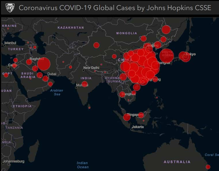
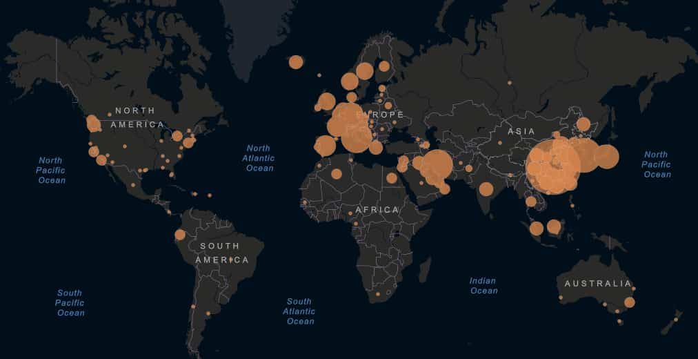
തൽസമയ ഭൂപടങ്ങൾ നമ്മൾ പ്രകൃതി ദുരന്തങ്ങളിൽ ഉപയോഗിച്ചു കണ്ടിട്ട്ള്ളതാണു ഇപ്പോൾ പകർന്നു വ്യാപിക്കുന്ന COVID19 അതിന്റെ വ്യാപന നിരക്ക് ,അതിന്റെ സഞ്ചാരപാത ഒക്കെ ഈ ഭൂപടത്തിൽ കൂടെ മനസിലാക്കുവാൻ കഴിയും.
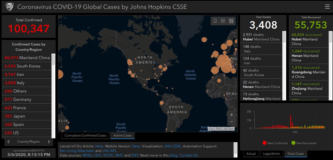
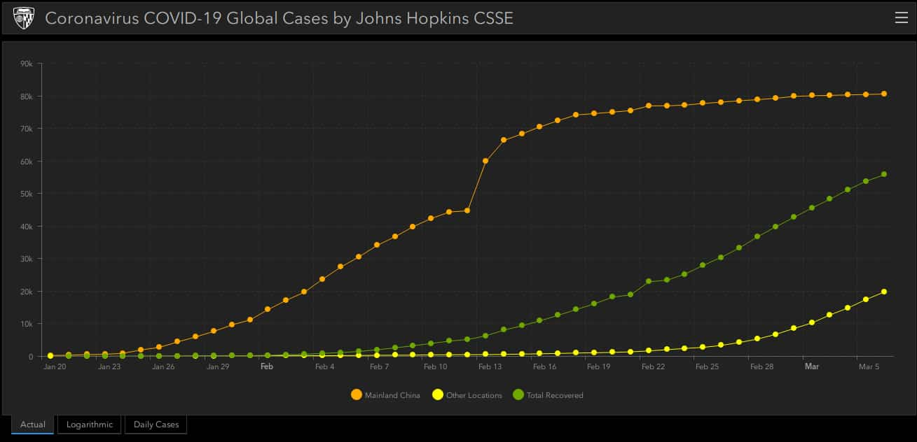
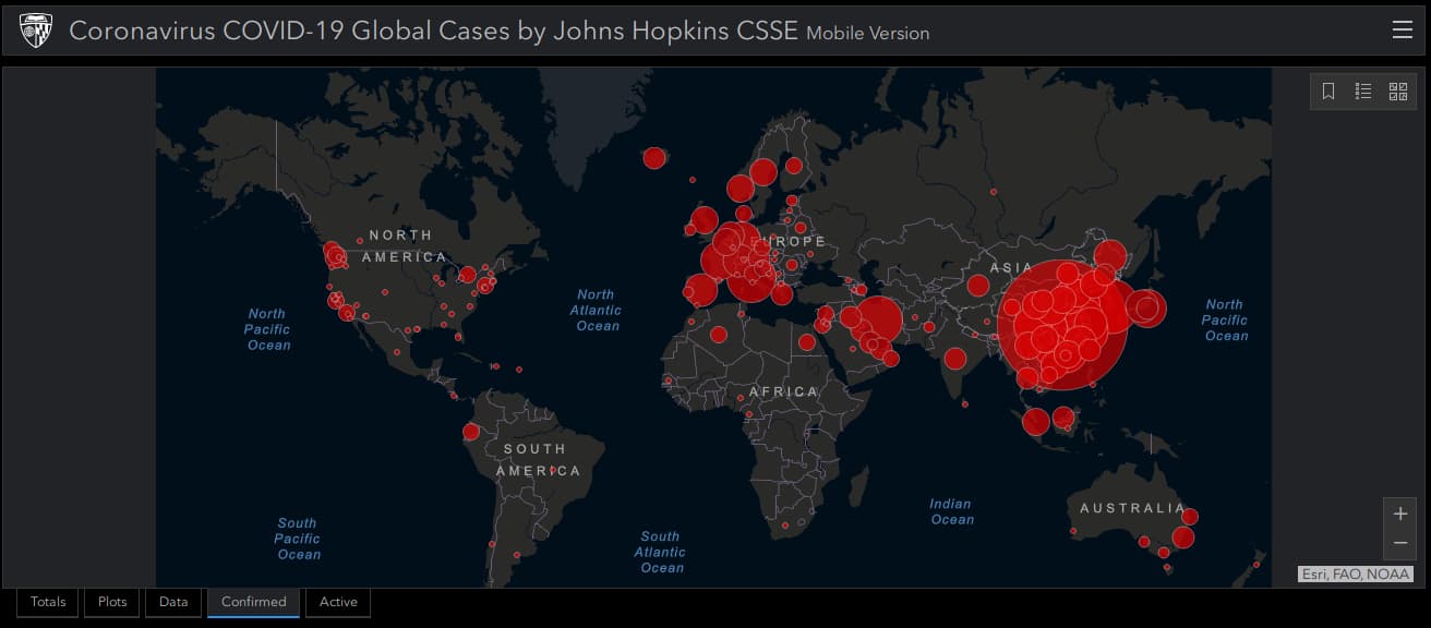
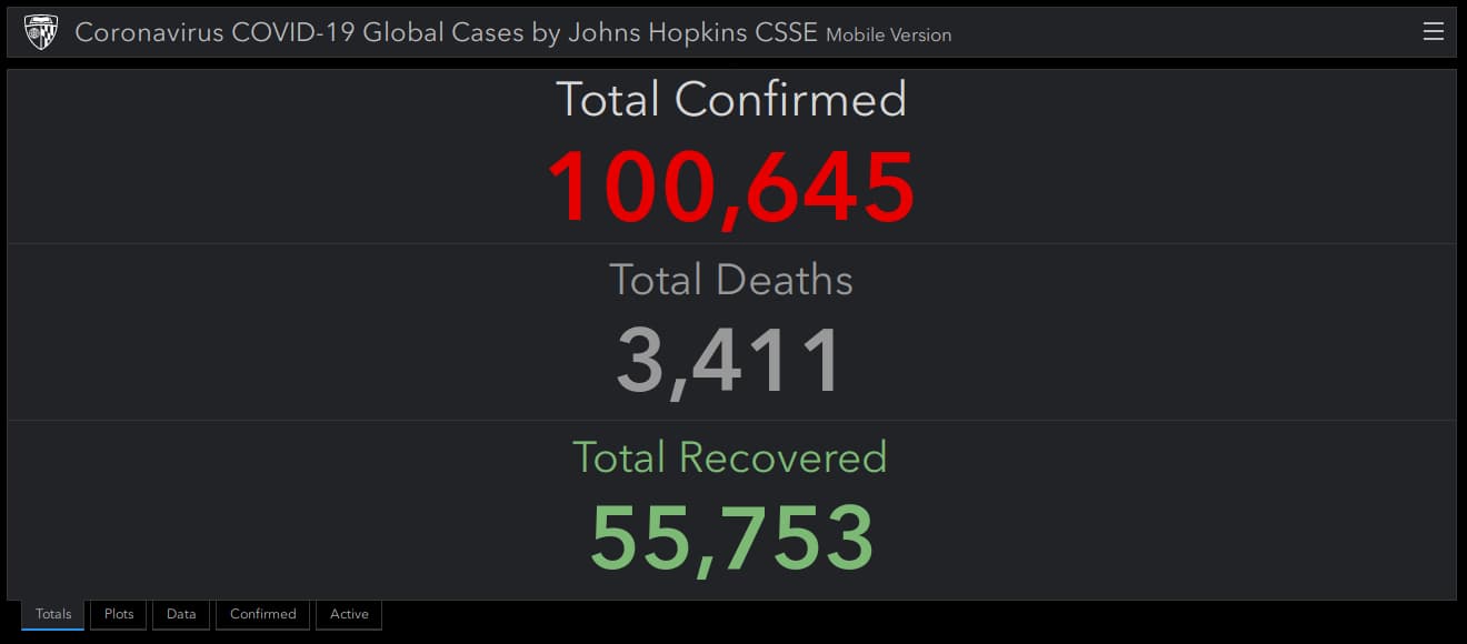
Coronavirus COVID-19 Global Cases by Johns Hopkins CSSE
കൂട്ടത്തിൽ ആധികാരികവും മാപ്പിങ് Desktop/Mobile പ്ലാറ്റ്ഫോർമിനും ഒരുപോലെ ലഭ്യമാക്കിയിരിക്കുന്നതു Coronavirus COVID-19 Global Cases by Johns Hopkins CSSE ആണ്. Geospatial ഭീമൻമാർായ ESRI ആണ് ഈ മാപ്പിങ് Johns Hopkins യൂണിവേർസിറ്റ്യുമായി സഹകരിച്ച് നടത്തുന്നത് .
Features - Desktop

Features - Mobile
Data Sources
ഈ തൽസമയ മാപ്പിങ്ങിൻനായി ഉപയോഗിക്കുന്ന വിവര സ്ത്രോതസ്സുകൾ: